A Comprehensive Guide: Navigating Locations with GPS Geolocation Vs. IP Geolocation


Introduction
Geolocation technology has become an increasingly important part of the digital landscape, with applications ranging from navigation to online marketing. It enables businesses to deliver location-specific content, personalize user experiences, and implement geographically targeted marketing strategies. When it comes to geolocation, two prominent methods stand out: GPS Geolocation and IP Geolocation. But how do you know which method is most suitable for your needs?
This blog will delve into the intricacies of both approaches and provide valuable insights into how to test them effectively on real devices. We'll also provide tips and tricks for testing geolocation on real devices, so you can decide which method is best for you. Along with a list of the best available geolocation testing tools, you'll have everything you need to ensure your geolocation solution works perfectly by the end of this article.
How Does GPS Geolocation Work?
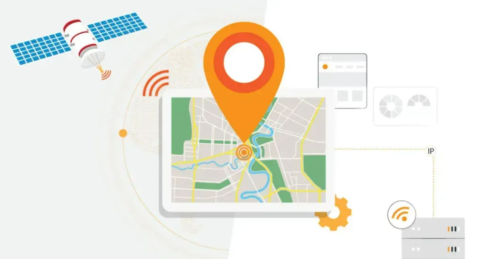
GPS Geolocation, also known as Global Positioning System Geolocation, is a powerful technology that leverages signals from a network of satellites to determine a device's geographic location precisely. By utilizing this technology, applications, and services can acquire accurate latitude and longitude coordinates, enabling a wide range of business functionalities and opportunities.
Pros and Cons of Using GPS Geolocation
GPS geolocation is a powerful tool that can provide abundant accurate location data. While it has drawbacks, such as the need for GPS receivers and cost considerations for large-scale testing, the benefits can often outweigh the negatives. For instance, GPS geolocation offers faster response times and more precise results when compared to IP geolocation services. Furthermore, some systems can use multiple satellite signals, which increases accuracy even further.
Ultimately, whether or not to use GPS geolocation comes down to an individual's needs and requirements. Those looking for fast response times and high-precision data may find this technology worth investing in. On the other hand, those who cannot afford the necessary hardware or do not require highly detailed information may be better off using IP geolocation instead. In any case, it is important to consider both pros and cons before deciding which solution best meets your needs.
Let's delve deeper into the key aspects of GPS Geolocation and explore how they enhance user experiences and drive business success.
Geotargeting
Geotargeting is a strategic approach that enables organizations to target respective users based on their physical location. Companies can deliver tailored content, advertisements, and promotions specific to their geographic region by understanding where users are located.
For instance, an e-commerce platform can customize its product offerings and promotions based on the user's location, showcasing items that are popular or relevant to that particular area. This approach enhances personalization, improves conversion rates, and fosters a deeper connection with the target audience.
Geofencing
Geofencing involves the creation of virtual boundaries within a physical area. With GPS Geolocation, businesses can leverage geofences to trigger certain actions or notifications when a user enters or exits a specific geographic zone. This feature has numerous real-world applications.
For instance, a retail store can use geofencing to send push notifications or exclusive offers to potential customers close to their physical location. Geofencing can also be utilized for location-based reminders, such as triggering a reminder for users to buy groceries when they enter a specific supermarket.
Geotagging
GPS Geolocation empowers the embedding of geographic metadata, known as geotags, into media files like photos or videos. Geotags provide additional context and enhance the user experience by associating media with specific locations. Social media platforms extensively use geotagging to enable users to share their location as well as experiences with their friends and followers.
For instance, when a user posts a photo on Instagram with a geotag of a famous landmark, it adds geographical information and allows others to discover and explore that location virtually.
Geoblocking
Geoblocking is a practice of limiting access to content or services based on a user's geographical location. GPS Geolocation browser test is pivotal in enforcing geoblocking measures, ensuring that only authorized users in specific regions can access certain resources. Streaming platforms often utilize geoblocking to comply with content licensing agreements.
For instance, a streaming service may restrict access to certain shows or movies based on the user's location due to regional licensing restrictions. By leveraging GPS Geolocation, these platforms can accurately determine the user's location and enforce the necessary content restrictions accordingly.
Localization and Internationalization
Localization and internationalization are critical to leveraging GPS Geolocation to create personalized and culturally relevant experiences for diverse audiences. By utilizing GPS data, businesses can provide region-specific content, language options, and cultural adaptations, enabling seamless user interactions and expanding their global reach.
Let's investigate how localization and internationalization strategies enhance user experiences and drive business success.
1. Region-Specific Content: Localization allows businesses to tailor their content based on the user's geographical location. For example, a news application can prioritize and display news articles relevant to the user's region. The application can automatically fetch news articles related to local events, sports teams, or weather conditions by utilizing GPS Geolocation. This ensures users receive content specific to their location, enhancing engagement and relevance.
2. Multilingual Support: With GPS Geolocation, businesses can automatically adapt their applications to the user's preferred language. For instance, a travel booking platform can detect the user's location and display the user interface, search results, and booking information in the user's preferred language. This eliminates language barriers and improves the overall user experience, enabling them to navigate and interact with the application effortlessly.
3. Cultural Adaptations: Localization goes beyond language and extends to cultural adaptations. By leveraging GPS Geolocation, businesses can tailor their applications to align with local customs, preferences, and conventions. For instance, an e-commerce platform can adjust the color schemes, imagery, and design elements based on the user's location. This cultural adaptation fosters a sense of familiarity and resonance with the local audience, increasing user satisfaction and trust.
4. Currency and Pricing: E-commerce platforms can utilize GPS Geolocation to display prices in the local currency, simplifying the purchasing process for users. By automatically converting prices and displaying them in the user's familiar currency, businesses eliminate confusion and provide a seamless shopping experience. Companies can also showcase region-specific discounts, promotions, or deals based on the user's GPS location, driving customer engagement and conversion rates.
5. Localized Search Results: GPS Geolocation enables businesses to deliver search results specific to the user's location. For example, a restaurant discovery application can utilize GPS Geolocation to display nearby restaurants, reviews, and ratings based on the user's location. This localized search experience saves users time and effort finding relevant information, making the application more valuable and user-friendly.
6. Customized User Interfaces: Localization allows businesses to tailor the user interface of their applications to align with local preferences and design conventions. By considering cultural nuances and visual aesthetics specific to the user's location, businesses can create a more engaging and intuitive user experience. This includes adapting icons, layouts, colors, and navigation patterns to suit local user expectations, improving usability and user satisfaction.
Exploring the Process and Applications of IP-Based Location Determination
IP Geolocation, also known as Internet Protocol Geolocation, is a technique that determines the device's geographical location based on its IP address. Every internet-connected device is assigned an IP address, serving as a distinctive identifier. IP Geolocation utilizes databases containing IP address ranges associated with specific locations to estimate the device's geographic position.
Pros and Cons of Using IP Geolocation
Identifying a user's physical location is integral to many online activities. GPS geolocation and IP geolocation are two common approaches; the former is more accurate but requires expensive hardware, whereas the latter is cheaper yet less precise. Ultimately, it may be best to try both methods before deciding which one to use in any situation.
IP geolocation has several benefits, making it an attractive choice for certain applications. The primary advantage of this method is its affordability - since there are no extra costs associated with using it, users can save money compared to GPS geolocation. Additionally, IP geolocation can provide data at a country level instead of pinpointing exact locations as GPS does, making it useful for situations where only general information about a user’s location is needed.
On the other hand, IP geolocation has some drawbacks that potential users should consider. Most notably, its accuracy suffers in rural areas and locations with inadequate internet access; in these cases, the data provided by IP geolocation may not accurately reflect the user’s actual physical location. Furthermore, while this method can offer approximate addresses for users’ locations, they cannot expect absolute precision from it as they would from GPS receivers.
Contrasting GPS Geolocation and IP Geolocation: Understanding the Variances in Location Determination Approaches
GPS Geolocation and IP Geolocation are two distinct methods used to determine a device's location, but they differ significantly in terms of accuracy, precision, and application. Understanding these differences is crucial when considering which approach to use in various scenarios.
Let's delve deeper into the disparities between GPS Geolocation and IP Geolocation:
1. Accuracy and Precision: GPS Geolocation relies on signals from satellites to provide highly accurate and precise coordinates. It can precisely determine the device's location, even in remote areas or without an internet connection. On the other hand, IP Geolocation utilizes databases and estimations to approximate the device's location based on its IP address. While IP Geolocation can provide a general idea of the device's whereabouts, its accuracy and precision may vary due to factors like IP address assignments and database inaccuracies.
2. Real-Time Updates: GPS Geolocation provides real-time location updates, making it ideal for apps that require precise and up-to-date tracking, navigation, or asset monitoring. GPS signals are received directly from satellites, so the device's location can be continuously updated. In contrast, IP Geolocation relies on static IP address assignments and database information, resulting in less frequent updates. Therefore, IP Geolocation is better suited for applications that don't require real-time tracking but can benefit from general location-based functionalities.
3. Device Requirements: GPS Geolocation necessitates a device with built-in GPS capabilities, such as smartphones or dedicated GPS receivers. These devices can communicate directly with satellites to determine the precise location. On the other hand, IP Geolocation operates on any internet-connected device, as it relies on the device's IP address. This makes IP Geolocation more accessible and applicable to a wider range of devices, including computers, tablets, and IoT devices.
4. Reliance on External Factors: GPS Geolocation relies less on external factors as it directly communicates with satellites. It can provide accurate location information even in areas with limited internet connectivity or when offline. In contrast, IP Geolocation relies on databases and estimations, which can be influenced by factors like IP address assignments, database inaccuracies, or VPNs or proxies that alter the perceived location.
5. Purpose and Use Cases: GPS Geolocation is particularly useful for applications that require precise tracking, navigation, or asset monitoring. It finds applications in logistics, transportation, sports, and outdoor activities. On the other hand, IP Geolocation is more suitable for general location-based functionalities, such as tailoring content based on the user's location, providing localized search results, or enforcing regional access restrictions.
Mastering GPS and IP Geolocation Testing Techniques
Understanding a user’s location is an important part of any web or mobile application, and geolocation accuracy can make all the difference in time and distance. Testing for geolocation on real devices is key to understanding how your application will perform in the wild and ensuring accuracy.
When configuring your device or application to simulate a user’s location, it’s important to consider both hardware-based GPS and IP-based geolocation services. Each method has its advantages and drawbacks, so it’s important to test websites from different countries by using both of these techniques to get an accurate understanding of how your application will perform when deployed. For example, GPS is more accurate but requires expensive hardware, while IP-based services are faster and cheaper but less accurate.
Testing for accuracy also requires checking for false positives and false negatives. False positives occur when a user's actual location is reported inaccurately, while false negatives occur when the correct location is not registered. Both of these errors can have serious implications for users relying on your application's accurate location data. Fortunately, tools allow you to test geolocation data from different sources to ensure accuracy and reliability.
Manual and Automated Approaches of Testing GPS Geolocation and IP Geolocation
Testing GPS Geolocation and IP Geolocation is essential to ensure the accuracy and reliability of geolocation functionalities in applications. Manual and automated testing approaches can be employed, depending on the specific requirements and resources available. Let's explore these testing methods in more detail:
Manual Testing
Manual testing involves physically moving to different locations with GPS devices. Testers observe the application's behavior and compare it with expected results to validate the accuracy of GPS Geolocation. By physically experiencing the application's response in different environments, testers can identify discrepancies and ensure that the geolocation functionalities function as intended.
For IP Geolocation testing, manual methods include using proxy servers or virtual private networks (VPNs) to simulate different IP addresses and locations. Testers can access the application from various virtual locations, mimicking users from other regions. By verifying if the geolocation functionalities behave correctly for each simulated site, testers can ensure that the application responds appropriately to IP-based location data.
Automated Testing
Automated testing employs specialized tools and frameworks to simulate different geolocation scenarios, enhancing efficiency and scalability. These tools enable testers to define specific coordinates or IP addresses and automate the testing process. Automating the testing workflow eliminates repetitive tasks, and comprehensive testing can be performed across multiple devices and platforms.
Various geolocation testing tools offer features that facilitate the emulation of GPS coordinates, IP addresses, and network conditions. With these capabilities, testers can create diverse testing scenarios, validate the application's behavior under different geolocation conditions, and ensure consistent performance across various devices and platforms.
HeadSpin, for instance, provides a comprehensive platform for testing and monitoring geolocation functionalities. It offers extensive device coverage, allowing testers to access various real devices across different platforms. The platform also offers detailed analytics and insights, empowering testers to monitor performance, identify issues, and optimize geolocation implementation for optimal user experiences.
Can GPS and IP Geolocation be Emulated Using Appium?
Appium, an open-source mobile automation framework, supports testing geolocation functionalities. Here's a step-by-step demonstration of how to emulate GPS and IP Geolocation using Appium:
Step 1: Install and Set Up Appium
Start by installing Appium on your testing environment. You can download and install Appium from the official website or use package managers like npm (Node Package Manager) for easy installation. Follow the installation instructions specific to your operating system.
Once Appium is installed, set up the necessary configurations, such as specifying the Appium server's address, port, and other desired settings.
Step 2: Define Desired Geolocation Coordinates or IP Address
Appium offers the desired capabilities feature to define the desired geolocation coordinates or IP address for your tests. This capability allows you to simulate different geolocation scenarios during testing. You can configure the desired capabilities using the programming language of your choice, including Java, Python, or JavaScript.
Here's an example using Java and the Appium Java client library:
DesiredCapabilities capabilities = new DesiredCapabilities();
// Emulating GPS Geolocation
capabilities.setCapability("locationServicesEnabled", true);
capabilities.setCapability("locationServicesAuthorized", true);
capabilities.setCapability("locationProvider", "gps");
capabilities.setCapability("gpsEnabled", true);
capabilities.setCapability("gpsSignalQuality", "Excellent");
// Emulating IP Geolocation
capabilities.setCapability("deviceName", "Android Emulator");
capabilities.setCapability("platformName", "Android");
capabilities.setCapability("appPackage", "com.example.app");
capabilities.setCapability("appActivity", ".MainActivity");
capabilities.setCapability("avdArgs", "-geo <latitude>,<longitude>");
// Other desired capabilities for your specific test scenario
// Set up the driver with the desired capabilities
AppiumDriver<MobileElement> driver = new AndroidDriver<MobileElement>(new URL("http://localhost:4723/wd/hub"), capabilities);
Adjust the desired capabilities according to your specific geolocation testing requirements.
Step 3: Implement Test Scripts
Implement your test scripts using the programming language and framework supported by Appium. You can create test scripts interacting with the application, perform geolocation-related actions, and validate the expected behavior.
Here's an example test script in Java using the Appium Java client library:
// Example test script for GPS Geolocation
// Set the geolocation coordinates
driver.setLocation(new Location(37.7749, -122.4194, 10)); // San Francisco coordinates
// Perform actions specific to GPS Geolocation testing
// Validate the application's behavior based on the simulated geolocation
// Example test script for IP Geolocation
// Perform actions specific to IP Geolocation testing
// Validate the application's behavior based on the simulated IP address
// Other test steps for your specific geolocation testing scenario
// Close the driver session
driver.quit();
Customize the test scripts according to your application and testing requirements, performing actions and assertions relevant to your geolocation functionalities.
Step 4: Execute the Test Scripts
Run the test scripts using your preferred test automation framework, such as JUnit or TestNG. Ensure that the Appium server is running during test execution.
Once executed, Appium will simulate the specified geolocation data, either GPS coordinates or IP address, on the target device or emulator. The application under test will respond to the simulated geolocation, allowing you to validate its behavior accurately.
Following these steps and customizing the code snippets to your specific geolocation testing needs, you can emulate GPS and IP Geolocation using Appium. This demonstration showcases the power and flexibility of Appium for comprehensive geolocation testing.
How Does HeadSpin's Global Device Infrastructure Streamline Geolocation Testing?
HeadSpin offers a comprehensive platform that empowers testers to test and monitor geolocation functionalities effectively. Here are some of the capabilities provided by HeadSpin specifically designed for geolocation testing:
1. Extensive Device Coverage: HeadSpin’s global device infrastructure provides access to an extensive collection of real devices across various platforms, including smartphones, tablets, and IoT devices. This wide device coverage allows you to test geolocation functionalities on multiple devices and operating systems. By ensuring compatibility across different devices, you can guarantee consistent and reliable geolocation performance for your application's users.
2. Real-World Network Conditions: HeadSpin empowers you to evaluate your application's geolocation features across diverse network environments, encompassing varying speeds, latency, and connection stability. This capability ensures thorough validation of real device cloud functionalities, delivering optimal performance to users in different connectivity scenarios.
3. Detailed Analytics: HeadSpin offers comprehensive analytics and insights for geolocation testing. By monitoring and analyzing key metrics, you can gain valuable information about the performance of your application's geolocation functionalities. HeadSpin provides detailed reports on metrics such as response times, accuracy, and stability, enabling you to identify bottlenecks, performance issues, or inconsistencies in geolocation data. This data-driven approach lets you make informed decisions, optimize your geolocation implementation, and enhance the user experience.
Conclusion
In conclusion, GPS and IP Geolocation are essential for determining a device's location. While GPS Geolocation provides accurate real-time coordinates, IP Geolocation offers an approximation based on IP addresses. To ensure the accuracy and reliability of geolocation functionalities in your devices or applications, thorough testing is crucial. Whether through manual methods or automated tools like HeadSpin, geolocation testing on real devices helps validate the desired behavior and deliver optimal user experiences.
Experience the power of comprehensive geolocation testing and leverage the full potential of your devices with HeadSpin.